
Maryland fits 11,684 miles of tidal shoreline into just 12,407 square miles, a geographic fact that helps explain why a small Mid-Atlantic state can feel dense, maritime, and regionally connected. Its borders touch Pennsylvania, Delaware, Virginia, West Virginia, Washington, D.C., the Atlantic Ocean, and the Chesapeake Bay, creating a state whose identity is shaped as much by water and boundaries as by cities and roads.
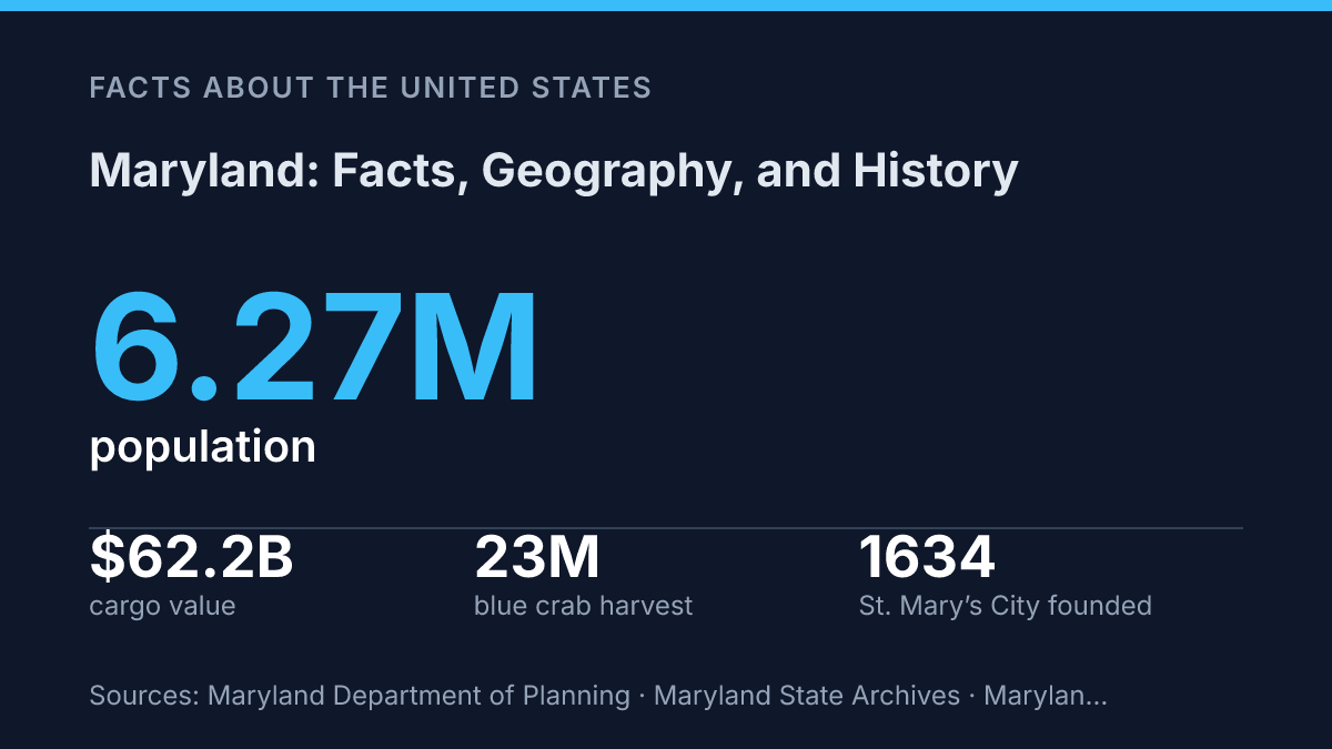
The same compactness links its colonial beginnings at St. Mary’s City in 1634 to modern population centers such as Montgomery County, Prince George’s County, Baltimore County, and Baltimore City. This article examines how location, settlement, industry, and culture fit together, from the Port of Baltimore and manufacturing base to blue crabs, state symbols, and the Chesapeake Bay traditions that remain central to public memory and daily life.
Where Maryland sits and what borders it
The Chesapeake Bay gives a relatively small state one of the most water-defined geographies in the United States, separating the Eastern Shore from the more urbanized western side while linking both to tidal commerce and fisheries. Its estuary system reaches far inland through rivers and coves, so water access is not limited to the Atlantic coast. That pattern helps explain why port activity, boatbuilding traditions, seafood harvesting, and shoreline communities are central to the state’s geographic identity rather than peripheral coastal features.
According to the Maryland Secretary of State, the state is about 250 miles long and 100 miles wide, bordered by Pennsylvania, Delaware, Virginia, West Virginia, Washington, D.C., the Atlantic Ocean, and the Chesapeake Bay, with a total area of 12,407 square miles, making it the 42nd-largest U.S. state. Those borders place it in the Mid-Atlantic, but they also connect it to several different regional systems: the Northeast corridor to the north, the national capital region to the southwest, the Delmarva Peninsula to the east, and the Appalachian interior to the west.
Geographic variety is compressed into a narrow east-west span. The Eastern Shore is low, flat, and closely tied to the Delmarva Peninsula, with farms, marshes, tidal creeks, and Atlantic barrier-island environments shaping settlement and travel. West of the bay, the Piedmont forms a rolling interior zone where many of the state’s largest communities developed along transportation routes between Washington, Baltimore, and points north.
The western edge changes character again as the land rises into the Appalachian region near the panhandle. This part of the state is more mountainous and less densely settled than the central corridor, creating a clear contrast with the tidewater and Piedmont areas. The result is a compact state whose borders, bay, ocean frontage, and upland edge create sharper internal divisions than its size alone would suggest.
How the state was founded and developed
St. Mary’s City remained the colonial capital for roughly 60 years, a sign that the first settlement quickly became a seat of law rather than only a private colonial foothold. The Maryland State Archives records its establishment on March 27, 1634, by English settlers operating under the Calvert family, whose proprietary charter shaped early government and landholding. The same source notes that the settlement hosted an early General Assembly and kept capital status until the seat of government moved to Anne Arundel Town, now Annapolis, in 1694/5.
The colony’s founding purpose was closely tied to religion, especially the search for a safer place for English Catholics within the British imperial system. That aim did not create a fully open society, since Protestants also settled there in large numbers and political power shifted repeatedly between religious factions. The Maryland Toleration Act of 1649, formally the Act Concerning Religion, protected worship for Trinitarian Christians and became one of colonial America’s best-known early toleration laws, but its protections were limited by modern standards and did not prevent later anti-Catholic restrictions.
Economic development also shaped the colony’s population and institutions. Tobacco agriculture encouraged large land grants, dispersed settlement, and a labor system that moved from indentured servitude toward racial slavery by the eighteenth century. This plantation structure left a durable social imprint: political authority was tied to landownership, while the population included European settlers, enslaved Africans, free Black communities, and Native peoples whose earlier presence was increasingly displaced by colonial expansion.
During the Civil War, the state occupied a tense position as a slaveholding border state that remained in the Union. Its proximity to Washington, D.C., made secession politically and militarily unacceptable to federal leaders, while divided local loyalties made the state difficult to govern.
Federal troops moved quickly to secure transportation routes and urban centers, and the 1861 Baltimore riot showed how fragile Union control could be. This wartime role reinforced a longer pattern in the state’s history: its institutions often developed through compromise, coercion, and conflict rather than through a simple story of early toleration.
Population centers and major industries
Baltimore City had an estimated 569,997 residents in 2025, yet several suburban counties each held far larger populations, showing how the state’s economy is split between an older urban port center and the capital-region suburbs. Baltimore remains the largest city and a major industrial and transportation hub, with activity tied to shipping, warehousing, manufacturing, health care, and higher education. In 2024, the Port of Baltimore handled 45.9 million tons of international cargo valued at $62.2 billion, including 749,799 autos and light trucks, according to the State Archives; that scale helps explain why maritime trade remains central even as the wider economy has become more service- and research-oriented.
The Washington, D.C.-area suburbs form the other dominant population and income center. Montgomery County had an estimated 1,074,582 residents in 2025, while Prince George’s County had 970,374, according to the state Department of Planning’s Vintage 2025 Census estimates.
Their proximity to the capital supports federal employment, professional services, defense contracting, biotechnology, and research-intensive industries. Montgomery County’s life sciences cluster is linked to federal research institutions such as the National Institutes of Health and to private biotechnology firms, while Prince George’s County benefits from federal offices, transportation links, and a large regional workforce.
Major industries reflect this dual structure. Health care and biomedical research are supported by large hospital systems, universities, and federal science agencies. Defense and cybersecurity contracting are reinforced by installations and agencies such as Fort Meade and the National Security Agency.
Manufacturing is smaller than the service economy but still significant: in 2024, the state had 4,978 manufacturing firms employing 112,981 people, and manufacturing contributed $28.58 billion to state GDP, according to the State Archives. The concentration of federal and defense-related work gives the economy a steady institutional base, but it also ties some employment and investment patterns to federal budgets, procurement decisions, and policy changes.
State symbols, culture, and well-known facts
Few U.S. flags are as visually tied to family heraldry as this state’s quartered black-and-gold and red-and-white banner. Officially adopted in 1904, the flag combines the Calvert design with the Crossland design: the black-and-gold pattern is associated with the Calvert arms, while the red-and-white cross bottony comes from the Crossland arms. The result is one of the most distinctive state flags in the country, partly because it does not rely on a seal-on-blue format common among many state banners.
Formal symbols reinforce the same mix of local identity and inherited imagery. The official state bird is the Baltimore oriole, a species whose orange-and-black coloring also connects visually with state and city symbolism.
The official state flower is the black-eyed Susan, a yellow-petaled flower with a dark center that is widely associated with public events and seasonal displays. The best-known nickname is The Old Line State, which remains a standard shorthand in reference works, tourism material, and civic branding.
Food culture often shapes the state’s public image as strongly as formal emblems do. Blue crabs are central to that reputation, especially through steamed crabs, crab cakes, and crab feasts seasoned with Old Bay, the spice blend closely associated with mid-Atlantic seafood.
The commercial scale behind the tradition is substantial: the state Department of Natural Resources estimated the 2025 commercial blue crab harvest at 23 million pounds, with an estimated dockside value of $51 million in its 2026 update. That figure shows why crab culture is not only symbolic but also connected to working waterfronts and regional food businesses.
Sports and recurring public events add another layer to general recognition. Baltimore’s professional baseball and football teams, the Preakness Stakes at Pimlico Race Course, and college athletics all contribute to a public identity that extends beyond official symbols. Taken together, the state’s best-known markers show a balance between heraldic inheritance, local natural symbols, and everyday cultural associations rooted in food, sport, and place.
Why the state’s compact geography still matters
Maryland’s small size makes its choices unusually visible. A port expansion, a shoreline restoration project, a housing decision near Washington, D.C., or a change in crab harvest management can affect trade, conservation, commuting patterns, and local identity within a short distance.
The state’s roughly 2 million acres of agricultural land and more than 500,000 acres of protected open space show that growth and preservation are not separate topics here; they occupy the same map. The practical consequence is clear: understanding the state requires reading its borders, waterways, and population centers together rather than treating geography, history, and culture as separate facts.
Frequently Asked Questions
Q: What is Maryland best known for?
A: Maryland is best known for its Chesapeake Bay coastline, its role in early American history, and its mix of urban and rural regions. The state also has a strong maritime identity shaped by fishing, shipping, and waterfront communities.
Q: Where is Maryland located?
A: Maryland is in the Mid-Atlantic region of the United States, bordered by Pennsylvania, Delaware, Virginia, West Virginia, and Washington, D.C. Its position places it between the Northeast and the South, which has influenced its culture and economy.
Q: Why is Maryland important in U.S. history?
A: Maryland played a major role in colonial America and the Civil War era, especially because of its location near the nation’s capital. Its history includes early religious settlement, Revolutionary-era politics, and strategic importance during the 19th century.
Q: What kind of geography does Maryland have?
A: Maryland has a varied geography that includes Atlantic shoreline, tidal estuaries, rolling piedmont land, and mountain areas in the west. This diversity supports different land uses and contributes to the state’s economic and ecological variety.
Q: What are some major cities in Maryland?
A: Baltimore is the largest city and a major economic center, while Annapolis serves as the state capital. Other important population centers include Frederick, Rockville, and Columbia, each contributing in different ways to the state’s population and services.