
Washington, D.C. began as a 1790 legal decision: the Permanent Seat of Government Act placed a federal district of no more than ten miles square on the Potomac after a House vote of 32 to 29. That narrow margin still helps explain why the capital feels both planned and contested, with national authority concentrated inside a city of 61.13 square miles and an estimated 693,645 residents in 2025. Its political geography is not incidental; the river location, the Capitol, the White House, and the Supreme Court define a civic core that millions encounter in person.
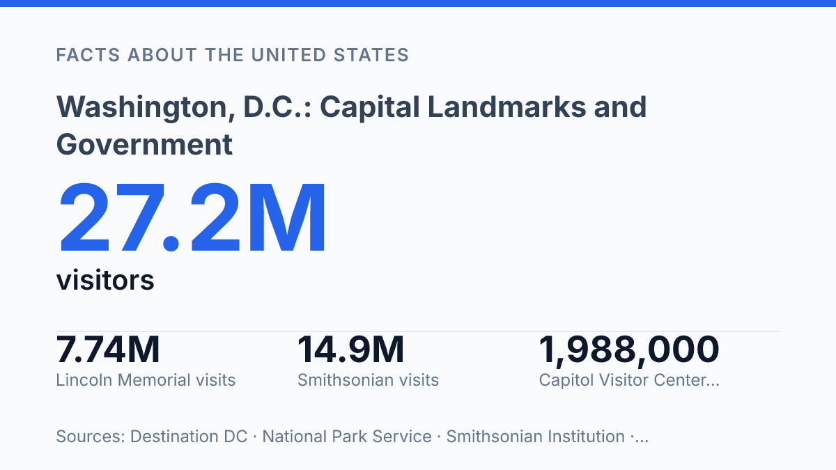
Visitor numbers show the scale of that role: Destination DC reported 27.2 million visitors in 2025, while the Lincoln Memorial alone recorded more than 7.7 million recreation visits. The article examines how site selection, federal power, memorial space, museums, and performance venues combine to make the capital a working seat of government and a cultural destination.
Why the city sits on the Potomac River
A national capital with a 2025 estimated population of 693,645 occupies just 61.13 square miles of land, according to U.S. Census Bureau QuickFacts. That small footprint is central to understanding why Washington, D.C. functions as a concentrated federal seat rather than a state-sized metropolitan territory. Its principal civic, administrative, and symbolic spaces are compressed into a district whose scale is closer to a compact city than to the broad jurisdictions that surround it.
The city’s placement on the Potomac River gives the capital both a geographic edge and a defining boundary. The river separates the district from Virginia along the west and southwest, while Maryland borders the district on its landward sides. This position places the capital between two states without making it part of either, a distinction that still shapes its legal and political identity.
Congress fixed the capital’s Potomac location in the Permanent Seat of Government Act, signed on July 16, 1790, which called for a federal district not exceeding ten miles square. The point was not to create another state capital or regional commercial center, but to establish a seat of national government under federal authority. That framework explains the city’s unusual status: it is a federal district, not a state, even though it has a large resident population, local neighborhoods, and municipal institutions.
This arrangement gives the capital national prominence while limiting local political autonomy compared with states. Residents live in the center of federal power, but the district’s authority remains shaped by congressional oversight in ways that state governments are not. The result is a city whose map reflects a constitutional compromise: physically bounded by Maryland, Virginia, and the Potomac, but politically set apart as the nation’s federal capital.
The three branches at the center of the capital
The Supreme Court did not receive its own purpose-built home until 1935, more than a century after Congress began meeting in the Capitol. Its marble building stands directly east of the Capitol, a placement that makes the judicial branch physically adjacent to the legislative one while preserving a separate institutional identity. The building’s formal classical design, raised entrance, and courtroom-centered plan reinforce the Court’s ceremonial authority, but access remains governed by active court schedules, security screening, and limited public seating when arguments are held.
The Capitol is the seat of Congress and the most prominent architectural marker of representative government in the city. Set on Capitol Hill, it anchors the eastern end of the city’s federal core and faces west toward the Mall, giving its dome a visual role far beyond its legislative function. Public interest is substantial: the Capitol Visitor Center received 1,988,000 visitors in FY2025, according to the Architect of the Capitol, which shows that the building operates both as a workplace for lawmakers and as a major civic destination.
The White House gives the executive branch a different kind of visibility because it is both the president’s residence and principal office. Its location at 1600 Pennsylvania Avenue places it north of the Mall rather than on the Capitol axis, creating a separate executive setting within walking distance of the other federal landmarks.
The surrounding President’s Park is far more accessible than the house itself; NCPC and National Park Service data report about 1.5 million annual visitors to the park between 2014 and 2024, while White House tours averaged about 488,200 annually over the same period, excluding 2020–2021. That contrast captures a defining feature of the capital’s government buildings: they are national symbols designed to be seen, but they remain controlled working institutions with security and access limits.
Monuments that shape the National Mall
A single westward view from the Washington Monument can take in more than two miles of lawn, water, and memorial architecture arranged as a national stage rather than a dense city street grid. The National Mall functions as the capital’s main open ceremonial space, with long sightlines and broad lawns that make processions, commemorations, protests, and everyday tourism part of the same civic setting. Its scale is deliberate: the open ground gives monuments room to be read from a distance, while also making the center of the city feel unusually formal and symbolic.
The Washington Monument anchors that composition with the simplest form on the Mall: a pale stone obelisk rising 555 feet 5⅛ inches above the grounds. Completed in 1884, it draws on ancient monumental vocabulary rather than the columned temple form used by many later memorials, which helps explain why it reads less like a building and more like a vertical marker. Its position near the center of the Mall’s cross-axis makes it a visual reference point from multiple directions, organizing movement as much as memory.
At the western end, the Lincoln Memorial gives the Mall one of its clearest neoclassical statements. Dedicated in 1922 and designed in the form of a Greek Doric temple, it turns commemoration into a processional experience: visitors climb the steps, enter a columned chamber, and encounter Daniel Chester French’s seated statue of Abraham Lincoln. The memorial’s prominence is reflected in visitation as well as form; the National Park Service reported 7,743,295 recreation visits there in 2025, ranking it fifth among all National Park System sites.
Together, these monuments show how the Mall concentrates recognition, orientation, and ritual in a relatively restrained set of forms. The same spaciousness that makes the area powerful for national ceremonies can also make it feel less like a mixed urban neighborhood than an outdoor civic room, where distance and symmetry are part of the message.
Major museums and performance venues
The Smithsonian Institution alone recorded 14.9 million visits in 2025, a scale that places museum-going alongside government and memorial sightseeing as a central part of the capital’s public identity, according to Smithsonian visitor statistics. The network includes major museums devoted to science, history, art, culture, and technology, with the National Museum of Natural History drawing 3.3 million visits that year. Other best-known institutions, including the National Air and Space Museum and the National Museum of American History, reinforce the city’s role as a place where national memory is presented through objects, archives, aircraft, spacecraft, inventions, and civic artifacts rather than ceremony alone.
As a museum system, the Smithsonian Institution also changes how the capital functions for visitors and residents. Its collections are not concentrated in a single building, so the cultural experience of the city is distributed across multiple large institutions with distinct missions. That structure broadens the meaning of the federal city: public education, scientific research, preservation, and exhibition stand close to the formal spaces of lawmaking and executive power, giving the capital a cultural infrastructure that extends well beyond politics.
The John F. Kennedy Center for the Performing Arts adds a different kind of national stage, centered on live performance rather than collections. In FY2024, the Kennedy Center hosted 1,800 performances and events, welcomed 1.4 million visitors, and reached 50 million more people through televised productions, events, and broadcasts, according to its Form 990 reported via Philanthropy.org. Those figures show how a venue physically based in the capital can project cultural programming far beyond the city.
This concentration of museums and performance spaces makes the capital unusually dense in cultural institutions, but compact geography can be misleading. Many of the best-known sites sit within a relatively small central area, yet the scale of the collections, performance schedules, security procedures, and visitor volume make them substantial institutions in their own right. The result is a capital whose identity is shaped not only by federal authority, but also by national culture made public through museums, archives, exhibitions, concerts, theater, and broadcast performance.
Why the capital’s compact design still shapes civic life
The city’s small footprint makes its public meaning unusually concentrated. A visitor can move from elected government to memorial architecture to national collections within a short radius, but that convenience also places security, preservation, transit, and public access under constant pressure.
The next phase of the capital’s civic life will likely be shaped less by adding new icons than by managing the demand around existing ones: nearly 2 million annual Capitol Visitor Center visits in FY2025, 14.9 million Smithsonian visits in 2025, and large audiences for the Kennedy Center show that federal space is also shared civic space. The practical consequence is clear: decisions about maintenance, crowd flow, and access policies will shape how the nation experiences its capital as much as the landmarks themselves.
Frequently Asked Questions
Q: What are the main government buildings in Washington, D.C.?
A: The city is defined by three major federal landmarks: the Capitol, the White House, and the Supreme Court. Together, they represent the legislative, executive, and judicial branches of the U.S. government. Their proximity is a direct result of Washington, D.C.’s role as the national capital.
Q: Why is Washington, D.C. the U.S. capital instead of a state capital?
A: Washington, D.C. was established as a federal district so the national government would not be located within any single state. Its compact location on the Potomac River helped make the seat of government distinct from Maryland and Virginia. That arrangement supports federal independence and centralises national institutions in one place.
Q: Which landmarks are most associated with Washington, D.C.?
A: The city is closely associated with neoclassical monuments and buildings that symbolise federal authority. The best-known examples are the Capitol, White House, and Supreme Court. These landmarks are central to the city’s identity and are among the most recognised in the United States.
Q: What museums and cultural venues are in Washington, D.C.?
A: Washington, D.C. is home to major museums and performing-arts institutions, including the Kennedy Center. These venues broaden the city’s role beyond government and make it a national centre for culture as well as politics. Their presence reflects the capital’s concentration of federally supported and public-facing institutions.
Q: Where is Washington, D.C. located geographically?
A: Washington, D.C. sits on the Potomac River and borders Maryland and Virginia. Its position gives it a compact urban form while placing it near two states rather than within one. That geography has shaped both its political status and its physical layout.