
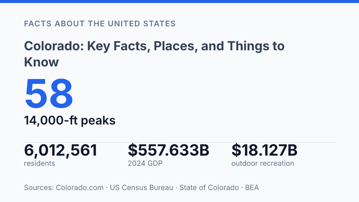
Colorado crossed 6 million residents in 2025, but the more revealing number might be 58: that’s how many peaks rise above 14,000 feet, more than in any other U.S. state. That contrast says a lot about the place. It’s growing fast, economically large, and heavily visited, yet its identity is still shaped by elevation, snowpack, water, and public land.
A dry year can matter as much as a jobs report; Denver International Airport passing 80 million passengers can help explain both opportunity and crowding. This guide looks at where the state sits, why its geography affects daily routines, how its cities and industries fit together, and why travelers keep returning even when conditions vary from basin to basin.
Where Colorado sits and what makes it distinct
Only one U.S. state touches Arizona at a single point while also bordering six other states: Colorado. It sits in the Mountain West, with Wyoming and Nebraska to the north and northeast, Kansas to the east, Oklahoma and New Mexico to the south, Utah to the west, and Arizona meeting it at the Four Corners point. That position makes the state feel like both a western crossroads and a bridge between the Rockies, the Great Plains, and the Southwest.
Denver is the state capital and its largest city, so it tends to anchor how many people first understand the state. It’s not just a political center; it’s also the main urban hub for population, transportation, business, and statewide media. According to U.S. Census Bureau QuickFacts, the state had 6,012,561 residents as of July 1, 2025, up 4.1% from the April 2020 estimates base, which shows how firmly it has crossed the 6 million mark.
The state joined the Union in 1876, exactly 100 years after the Declaration of Independence, which is why its nickname is the “Centennial State.” That nickname is a quick historical marker rather than the whole story, but it’s one of the basic facts that helps explain the state’s identity within the U.S.
People often picture only high peaks and ski towns when they think of the state, but that leaves out a major piece of the map. The eastern plains cover a large share of the state and connect it to the agricultural and transportation patterns of the central U.S. So while the mountains may dominate the image, the plains help shape how goods move, how communities are spaced, and how the state links westward terrain with the country’s interior.
How the state’s geography shapes daily life
No other U.S. state has as many peaks above 14,000 feet: 58, according to the official state tourism site, which helps explain why elevation shapes routines here as much as scenery does. The Rocky Mountains run through the middle and west of the state, while the Front Range marks the dramatic rise from lower urban corridors into foothills and high country. Farther west and southwest, high plateau areas, including the Colorado Plateau edge, create a different kind of terrain: broad mesas, canyons, dry basins, and long-distance drives where services can be spaced far apart.
Elevation changes what people plan for day to day. The state’s high point, Mount Elbert, reaches 14,440 feet, but even communities well below that can sit high enough for thinner air, stronger sun, and quick weather shifts to catch newcomers off guard. For residents, that can mean keeping extra layers in the car, watching mountain pass conditions, and treating winter travel as something that may take longer than the map suggests.
Snow is both a resource and a complication. Ski areas, backcountry trails, river flows, reservoirs, and summer wildfire conditions are all tied in some way to mountain snowpack, but the amount can swing from year to year. The snow-water equivalent across the state was 85% of median on April 1, 2025, compared with 112% on the same date in 2024, according to the USDA NRCS snow survey, a reminder that a snowy reputation doesn’t mean every basin has the same conditions.
That contrast is especially clear between mountain counties and lower-elevation urban areas such as Denver, Colorado Springs, and Pueblo. A dry, mild day along the urban corridor can coincide with snow, chain restrictions, or closed high routes farther west. That’s part of the appeal for skiing, hiking, climbing, and scenic drives, but it also means visitors should build in time, check forecasts by elevation, and remember that distance in miles doesn’t always match travel time in the mountains.
Cities, economy, and major industries
At $557.633 billion in 2024 GDP, the state’s economy is big enough that no single industry can explain it, according to the State of Colorado Annual Comprehensive Financial Report. Finance, insurance, real estate, rental, and leasing made up the largest industry grouping at $119.555 billion, or 21.4% of state GDP, which is a useful reminder that the headline sectors aren’t the whole story.
Denver anchors much of the business activity, helped by Denver International Airport, which served 82,358,744 passengers in 2024, according to the airport. Nearby Aurora is tied closely to health care, federal activity, and the airport corridor, while Boulder and Fort Collins have strong links to research, startups, and university-driven employment. Colorado Springs adds a major aerospace, defense, and military presence, giving the urban corridor several distinct economic centers rather than one oversized downtown doing all the work.
Aerospace is one of the clearest examples of that mix. Lockheed Martin has a major presence in the Denver area, and Ball Aerospace has long been associated with space systems and advanced engineering. The tech sector overlaps with that talent base, especially around Boulder, Denver, and Fort Collins, where software, data, communications, and bioscience companies draw from local universities and research networks.
Higher education is more than a classroom story here. The University of Colorado and Colorado State University support research, medical and scientific work, skilled-worker pipelines, and local spending in the cities around their campuses. Energy and agriculture still matter too, especially when you look beyond the densest urban counties, with farming, ranching, renewables, and oil and gas all contributing in different parts of the state.
Outdoor recreation connects the economy back to the places people recognize first. According to the Bureau of Economic Analysis outdoor recreation data summary, the sector contributed $18.127 billion to the state economy, equaled 3.3% of state GDP, and supported 137,762 jobs.
That doesn’t mean recreation carries the economy by itself, but it does show why gear companies, guiding services, hospitality businesses, public lands, and local main streets are tied together. The tradeoff is that growth along the Front Range has also intensified pressure on housing costs and transportation, especially where job centers, campuses, and commuting routes cluster tightly together.
Why visitors keep coming back
A single trip can move from Ancestral Pueblo cliff dwellings to alpine lakes to a dune field made for sandboarding, but your legs may notice the elevation before your itinerary does. The scale of travel here is real: the state recorded 96.8 million visitors in 2025, and travel generated $1.91 billion in state and local tax revenue, according to the state tourism office.
The national parks explain a lot of that pull without all feeling the same. Rocky Mountain National Park draws people for hiking, wildlife watching, lake trails, and Trail Ridge Road, one of the classic scenic drives when conditions allow. Mesa Verde National Park offers a very different kind of visit, centered on preserved Ancestral Pueblo sites and cliff dwellings rather than summit views. Great Sand Dunes National Park and Preserve adds another contrast, with huge dunes, creek play in season, night skies, and hikes that can feel tougher than they look because sand makes every step work harder.
Outdoor trips don’t have to be complicated, but they do reward planning. Skiing and snowboarding shape winter travel in resort towns, while warmer months bring hiking, rafting, camping, mountain biking, fishing, and scenic drives. Many visitors build a trip around one main activity and leave room for slower stops, because distances, weather, and altitude can turn an ambitious day into a rushed one.
Season matters as much as the destination. Winter can limit access to high routes, and higher passes may close or require traction laws when storms move through.
Even in late spring or early summer, snow can linger on shaded trails and at higher elevations, while summer afternoons can bring fast-changing weather. Trail Ridge Road is especially tied to seasonal conditions, so it’s smart to check current park and road updates before treating it as a guaranteed shortcut or sightseeing route.
That variation is part of why people return. One area can feel relaxed and easygoing, while another asks for more time, warmer layers, extra water, or a slower pace. If you match the activity to the season and give altitude some respect, the state’s biggest draws become much easier to enjoy rather than simply squeeze into a checklist.
Why the next decade will test the balance
The next useful step is to read the numbers as pressure signals, not trivia. A state can welcome nearly 97 million visitors, run an airport past 80 million passengers, and still face dry basins that change rafting seasons, wildfire risk, and municipal planning. If you’re moving, investing, or planning a trip, the practical takeaway is the same: check conditions at the local level.
A healthy statewide economy or a strong tourism year doesn’t tell you whether one valley has enough snowmelt, whether a trailhead is crowded, or whether housing costs fit your budget. The state’s appeal is real, but its tradeoffs are increasingly local and seasonal.
Frequently Asked Questions
Q: What is Colorado best known for?
A: Colorado is best known for its mountain scenery, outdoor recreation, and ski resorts. People also know it for major cities like Denver and for having a mix of urban, rural, and high-elevation communities. If you’re planning a visit, the state’s varied terrain is a big part of the appeal.
Q: When is the best time to visit Colorado?
A: That depends on what you want to do. Winter is popular for skiing and snowboarding, while late spring through early fall is usually better for hiking, road trips, and national park visits. Weather can change fast in the mountains, so packing layers is a smart move.
Q: Do you need a car to get around Colorado?
A: A car makes it much easier to explore the state, especially if you want to see mountain towns, parks, or trailheads outside the main cities. In Denver and some nearby areas, public transit can cover basic travel, but it’s limited once you head farther out. If your trip includes multiple destinations, driving is usually the simplest option.
Q: How high is the altitude in Colorado?
A: A lot of Colorado sits at high elevation, and that can affect how you feel on arrival. You may notice shortness of breath, headaches, or fatigue if you’re not used to thinner air. Drinking water, taking it easy on the first day, and avoiding overexertion can help.
Q: What should first-time visitors know before going to Colorado?
A: Give yourself time to adjust to the altitude, especially if you’re coming from sea level. Weather can shift quickly, even on a sunny day, so layers and sun protection are both useful. If you’re heading into the mountains, check road and trail conditions before you go.