
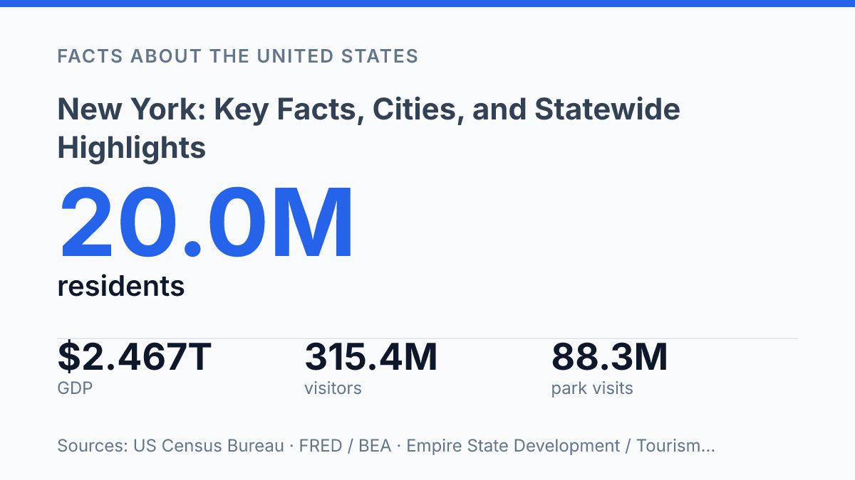
New York borders five U.S. states and Canada, yet NOAA also classifies it across four coastal regions, a mix that makes the state harder to define than a simple Northeast label suggests. Its profile is similarly uneven: the Census Bureau estimated 20,002,427 residents on July 1, 2025, down 1.0% from the 2020 base, while current-dollar GDP rose to $2.467 trillion in 2025. Those figures point to a state where population change, economic scale, education levels, tourism, and public land use do not move in one direction.
The details matter because the state’s counties, cities, waterways, parks, and economic centers explain different parts of its national role. This guide sets out the geography, population structure, major urban centers, economic and educational indicators, and the landmarks and natural features that give the state its unusual range.
Where New York sits and what it borders
A state commonly reduced to its largest city also touches two Great Lakes, the Atlantic Ocean, Canada, and five other U.S. states. As of 2026, state boundary law identifies Connecticut, Massachusetts, Vermont, Pennsylvania, and New Jersey as its five U.S. states along with Canada, while NOAA classifies the coastal geography into four distinct areas: Long Island, the state’s largest-city coast, the Hudson River Valley, and the Great Lakes–St. Lawrence region, according to NYSenate Open Legislation, 2026; NOAA Office for Coastal Management.
Those borders place the state at the meeting point of the Mid-Atlantic, New England, the Great Lakes, and the Canadian frontier. Pennsylvania and New Jersey frame much of the southern and southwestern side, while Connecticut, Massachusetts, and Vermont define the eastern side in stages. The northern boundary reaches Canada, giving the state an international edge as well as a set of regional identities that differ sharply from the downstate metropolitan area.
Water is central to that position. Lake Erie touches the state in the west, and Lake Ontario runs along a broad northern shoreline, linking the state to the Great Lakes system. On the southeastern end, Atlantic access comes through New York Harbor, one of the defining geographic features of the lower state and the maritime outlet for the country’s largest city.
The state capital is Albany, located inland on the Hudson River, while New York City is the largest city and the best-known urban center. That contrast helps explain why the state is often discussed in shorthand but cannot be understood only through its largest metropolis. Its map includes Great Lakes shoreline, Hudson Valley corridors, interior uplands, border communities, and Atlantic-facing coastal areas.
Population, major cities, and how the state is organized
A single municipal government contains five county-level boroughs, a setup that makes the state’s population map unusually uneven. The U.S. Census Bureau recorded 20,201,249 residents in the 2020 Census, placing the state among the most populous in the country. More recent Census Bureau QuickFacts estimates put the population at 20,002,427 as of July 1, 2025, a 1.0% decline from the April 2020 estimates base, showing that the statewide total has been relatively flat rather than steadily rising.
The largest concentration of residents is in New York City, which is organized into five boroughs: Manhattan, Brooklyn, Queens, the Bronx, and Staten Island. Each borough aligns with a county-level unit, giving the city an unusual local-government structure in which municipal services operate citywide while borough identity still matters for courts, elections, land records, and local administration. Bronx County was established in 1914, according to state local government records, making it the newest county-level unit in that borough system.
Outside the largest city, the state’s urban network includes Buffalo, Rochester, Syracuse, and Yonkers, each serving as a regional center for employment, health care, education, and local government. These cities are much smaller than the downstate population core, but they anchor metropolitan areas across western, central, and lower Hudson Valley communities.
The broader structure is county-based: the state has 62 counties, which handle functions such as public records, courts, elections administration, public health coordination, and social services. This creates a major contrast in everyday governance and density. Downstate counties hold dense urban and suburban populations, while many upstate counties cover larger land areas with smaller cities, villages, towns, and rural communities spread across them.
Economy, education, and national influence
The state’s current-dollar GDP reached $2.467 trillion in 2025, up from $2.322 trillion the year before, according to Federal Reserve Bank of St. Louis data drawn from the U.S. Bureau of Economic Analysis. That scale reflects a diversified economy, although its highest-value activity is not evenly distributed across the map. Finance remains the most visible sector, with Wall Street and the New York Stock Exchange serving as global symbols of capital markets, trading, investment banking, and corporate finance.
Media and communications add another layer of national influence, especially through publishing, advertising, television, film, and digital content businesses clustered in the downstate economy. Healthcare is also a major employer through hospital systems, medical schools, research centers, and specialized care networks.
Manufacturing has a smaller public profile than finance, but it remains important in areas such as food production, advanced materials, machinery, and technology-related supply chains. Tourism links urban attractions with parks, historic sites, cultural institutions, and regional travel; Empire State Development and Tourism Economics reported 315.4 million visitors in 2024, with $94.0 billion in visitor spending and $145.2 billion in total economic impact.
Higher education reinforces the state’s economic reach by drawing students, research funding, faculty, and employers into its major metropolitan and regional centers. Columbia University, Cornell University, and New York University are among the best-known institutions, while the wider public and private college network supports professional training in business, medicine, engineering, law, the arts, and public service. Census Bureau estimates for 2020–2024 show that 40.2% of residents age 25 and older held a bachelor’s degree or higher, a workforce measure that helps explain the state’s concentration of knowledge-based industries.
The same concentration that powers finance, media, healthcare, and university research also creates sharp geographic contrasts. High-income districts and job clusters in major corridors coexist with rural and postindustrial areas where employment bases, housing markets, and public finances can look very different. As a result, the state’s national influence is broad, but its economic benefits are distributed unevenly across regions.
Landmarks and natural features that define the state
Niagara Falls gives the state one of North America’s most recognizable natural border features, yet much of its defining geography lies far from the urban image most often associated with it. The falls sit on the U.S.-Canada border, where the Niagara River connects major freshwater systems and forms a dramatic public landmark shared across the international boundary. Its significance is not only scenic; it reinforces the state’s long connection to waterways, power generation, transportation, and cross-border movement.
Farther east and south, the Adirondack Mountains and Catskill Mountains anchor large portions of the state’s upland geography. The Adirondack Park covers about 6 million acres, and the Adirondack Park Agency reports more than 3,000 lakes and 30,000 miles of rivers and streams within the park.
That scale matters because it places one of the largest protected public-private land areas in the contiguous United States inside a state often identified with dense streets, rail lines, bridges, and high-rise development. The Catskills, while smaller and closer to the lower Hudson region, have also shaped water supply, recreation, forest conservation, and the cultural geography of upstate communities.
The Hudson River remains the clearest natural corridor tying these contrasts together. Flowing from the Adirondack region toward the lower part of the state, it has served as a route for settlement, commerce, ecological exchange, and regional identity. Its valley helps connect interior mountains, smaller cities, agricultural areas, suburbs, and dense metropolitan infrastructure without reducing the state to any one of those settings.
Public use of natural and historic spaces also shows how broad this identity is. The state governor’s office reported 88.3 million visits to state parks, historic sites, campgrounds, and trails in 2024, a record level and more than 4 million above the prior year. That figure helps explain why statewide generalizations can be misleading: the same state is defined by intense urban infrastructure and by large areas of protected or sparsely developed land.
Why the state is best read in layers
Statewide facts are most useful when they are compared across regions rather than treated as a single profile. A county map explains one set of realities, a coastline map another, and park visitation another still; none replaces the others. Future changes in population, coastal management, tourism demand, and outdoor recreation will likely make those regional distinctions more important, not less.
A practical next step for research, planning, or travel is to separate city data from upstate, Long Island, Hudson Valley, and Great Lakes indicators before drawing conclusions. The same state can record a slight population decline, a rising $2.467 trillion GDP, and record park use because its strengths and pressures are distributed unevenly.
Frequently Asked Questions
Q: What is New York best known for?
A: New York is known for New York City, major financial institutions, Broadway, and a highly diverse population. The state also includes large areas of farmland, mountains, lakes, and coastal regions. These contrasts make it one of the most varied states in the country.
Q: Which city is the largest in New York State?
A: New York City is the largest city in the state by a wide margin. It is also the state’s most populous urban center and the main hub for finance, media, and tourism. Other important cities include Buffalo, Rochester, Yonkers, and Syracuse.
Q: What are some major geographic features of New York?
A: The state includes the Adirondack Mountains, the Catskills, the Hudson River, the Great Lakes shoreline, and Long Island. Its geography ranges from dense urban centers to rural valleys and forested highlands. This variety shapes climate, recreation, and settlement patterns across the state.
Q: What is the capital of New York State?
A: Albany is the capital of New York State. It serves as the center of state government and is located in the eastern part of the state along the Hudson River. While much smaller than New York City, it plays a central administrative role.
Q: What industries are important in New York?
A: Finance, healthcare, education, tourism, manufacturing, and agriculture all play significant roles in the state economy. New York City is especially important for banking and media, while upstate regions contribute more to manufacturing, farming, and higher education. This economic mix supports both urban and rural communities.